The purpose of a topographic survey is to collect survey data about the natural and man-made features of the land, as well as its elevations. This data is later presented as contour lines on a 2D drawing. However, the point here is, we live in a 3 dimensional world. Therefore, it’s not easy for users to understand what is on the surface if they are not a professional land surveyor.
Here at GTS, we can make it easier by using advanced technologies such as GPS RTK, DGNSS, Laser Scan, Air Robotic with LIDAR tech which can build 3D maps, aiming to express more accessible visual detail for users.
Based on deep knowledge in this field, GTS's professional land surveying team can provide visible, accurate topographic results, saving you both time and money for your projects.
Our Topographic Survey Services include:
- Topographic, Create 3D Map and Air Robotics Image Combines
- 3D Structure Scan for As-built, Data Storage
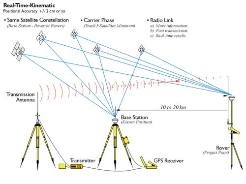
GPS RTK system (Precision 3-5cm)

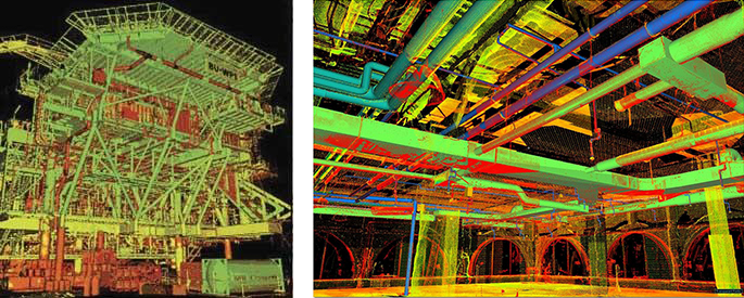

Laser Scaning survey